Pakistan's gateway to another world
-
-
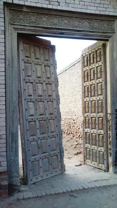
This gate in Derawar Fort is not yet covered in graffiti. But the interiors of the fort, which was once inhabited by the former rulers, have certainly seen a spray can or two. -
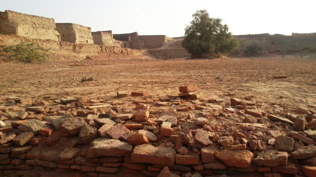
Built by the Hindu Rajput Rai Jajja Bhati, Derawar Fort is located in the Cholistan Desert, just a few hours away from the "City of Palaces", Bahawalpur, in the southern Punjab. It is just one of the many fortresses and archaeological sites to be found in Cholistan, which – despite their historical value – lie almost untouched amidst the steppe and sandy dunes of Pakistan's Punjab region. -
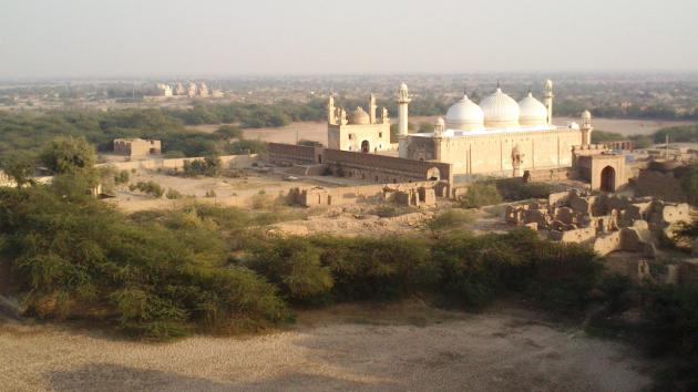
The Abbasi Mosque stands as testimony to the changing rulers of Bahawalpur and their religious beliefs. Derawar Fort, which was captured in 1733 by the Nawab of Bahawalpur, Sadeq Mohammad Khan I, is located nearby, overlooking the mosque. -
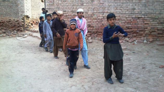
The cultural heritage site is a popular place for excursions. School classes and families often come here in the afternoons to play catch or hide and seek, and to marvel at the mighty fortress walls. Pictured here: school children on an excursion to Derawar Fort. -
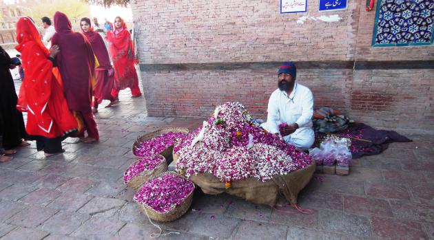
"Mystery glows in the rose bed. The secret is hidden in the rose." (Farid ud-Din Attar) Sufi worshippers at the shrine of Hazrat Bahauddin Zakariya buy a handful of rose petals from this man to pay tribute to the saints -
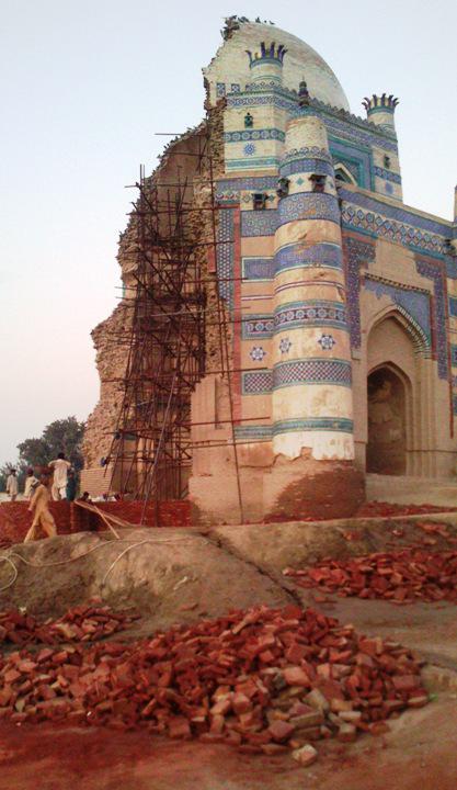
The tomb of Bibi Jawindi. Even as a construction site, this sanctuary in Uch Sharif is still beautiful to behold. The UNESCO World Heritage Site is currently being reconstructed. Floodwaters washed away large sections of the building in 1817. -
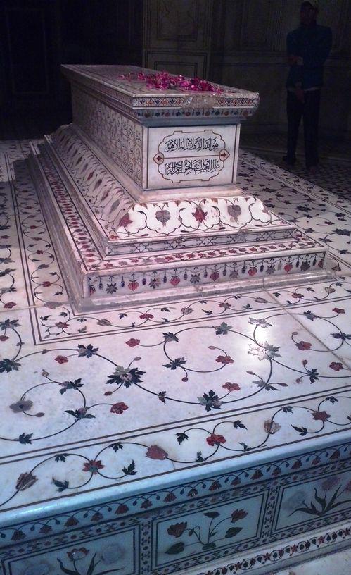
The Tomb of Jahangir, Lahore. The floral ornament hardly betrays the age of the tomb. In fact, this is the tomb of the fourth Mughal Emperor Nuruddin Shah Jahangir Padshah Ghazi, dating from the seventeenth century. His son Shah Jahan, builder of the Taj Mahal, and his widow Nur Jahan, had the tomb built for him. -
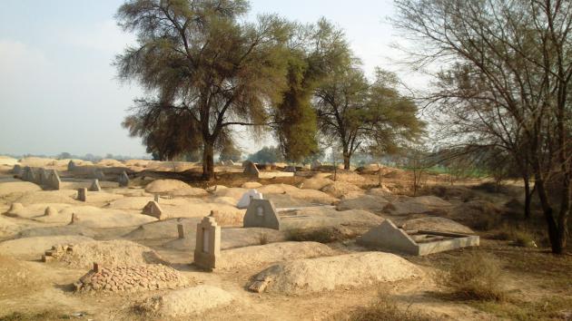
A different prospect is offered by the graves in the vicinity of a Bahawalpur village. Only a few are furnished with tombstones and names, let alone embellishments or ornament. Instead, modest, carefully shaped clay mounds are all that mark the resting places of the dead. -
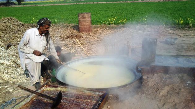
Here, the sugar is handmade! The watery light-yellow juice of the sugar cane is heated at high temperatures until it thickens. -
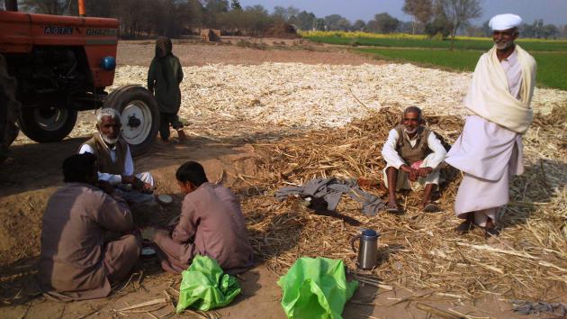
While the sugar cane juice simmers, these tenant farmers sit down on the ground to eat. A sense of community is a matter of course here – working without any friends or relatives is unusual. -
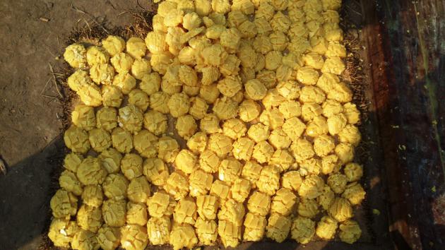
In this case, the end product – well-formed lumps of yellow sugar – is intended for personal consumption by families and friends in the village. Usually, the sugar factories in the surrounding regions of Punjab and Sindh are responsible for the large-scale production and sale of sugar. -
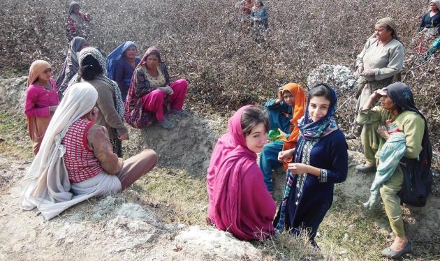
These women come almost daily to pick cotton in the fields near their village. Their husbands farm the land or run small shops in the market place. It's early February, the end of the season. The cotton plants yield little at this point, and five kilograms are worth only a third of what the women earned just a few months ago, at the beginning of the season. But that also means they have more time for chat at the roadside. -
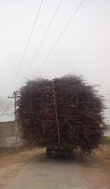
Shrubs, branches, wood. A large portion of the Pakistani population has to deal with power outages every two hours due to the energy shortage. Especially in the winter, firewood is vital for cooking, heating and sometimes even as a source of light. The many overloaded vans are simply part of the daily balancing act on the roads here. And if one of them should tip over, there are plenty of helping hands to set it upright again. -
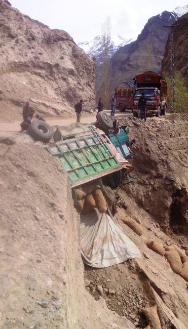
Off-road truck: on the way north, in the region of Gilgit-Baltistan, a van went off the road and got stuck between boulders and rocks on the mountainside. A day earlier, heavy rains had caused the crumbling roadside to give way. Even if the goods were lost, at least it was possible to get the truck back on its four wheels. -
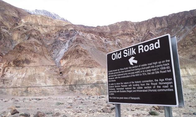
The horizontal brown line along the mountainside is the Old Silk Road. It was still in regular use up until the 1970s. Today, it is the Karakorum Highway, a motorway patched up by the Chinese government for the transportation of goods from Kashgar, China, to the Pakistani capital, Islamabad. The Old Silk Road is now buried beneath debris in places. Nevertheless, a few local shepherds still use it. -
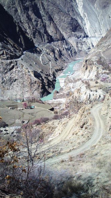
The Karakorum Highway runs through the world's highest mountains: the Hindu Kush, the Himalayas and the Karakoram ranges meet at the point where the Indus River winds its way through the rock. Year after year, climbers ascend the 8,125-metre-high Nanga Parbat nearby. Pictured here is a view of the highway. -
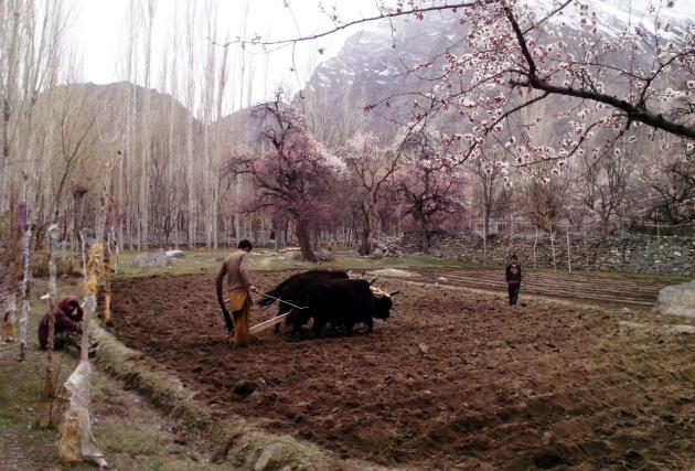
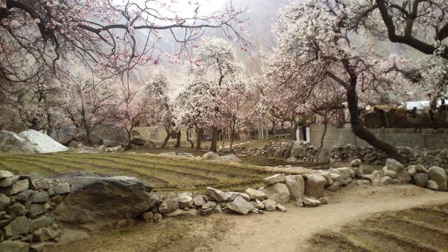
In the Shigar Valley, the starting point for the climb to the base camp of the world's second-largest mountain, K2, the fields are tilled with a wooden plough pulled by yaks. In the spring, the view of the surrounding villages is especially idyllic, with the apricot trees in full bloom. -
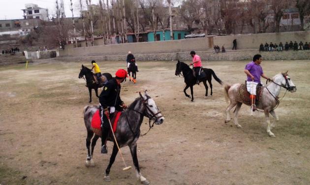
Polo is popular in Skardu. On Friday afternoons when the weather is good, the players meet on a polo field in town. If it rains, however, the game, which only lasts 20 minutes, has to be cancelled. -
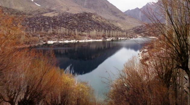
Upper Kachura Lake is located at an altitude of 2,500 metres above sea level, behind a village. It overlooks the Shangri-La resort that was so popular in the 1980s – the oldest resort in Pakistan. Even if the number of European visitors has dwindled over the past two decades, this area still feels like paradise. -
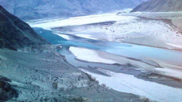
Cultivation in the Shigar Valley is only possible at the edge of the river because the valley's climate is very harsh with its glaciers and steep mountainsides. As the mountains in this region are still growing, some major changes in the landscape are inevitable.
https://qantara.de/en/node/33066
Link
To all image galleries